
Mapping
What you look after and what you do to it are geographic before they are anything else.
Everything in your inventory, and the work concerning it, on a map you configure yourself.
With addresses and coordinates read from the official Belgian registers rather than retyped.

Three requests on the same corner
Without a map, a coordinator cannot see that three open requests sit within thirty metres of each other, and each one is treated as its own small job.
Meanwhile coordinates get copied by hand from a regional viewer into a spreadsheet column, and addresses are retyped and misspelled instead of being taken from the register that already holds them.
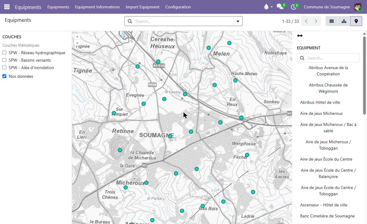
Your territory, with the layers your region publishes
Federal topographic maps, regional aerial photography and thematic layers stack over each other. Anything published as a standard map service can be added by configuration, and a preset can differ from one service to the next.
What changes
Mapping is not an application of its own. It is a way of looking at what is already there.
Position your assets once, not every request
Work appears at the place it concerns. A request on a classroom shows at the school, a request on a house number shows on its street. This is what makes the maps useful on day one.
Addresses from the official register
Municipalities, streets and house numbers come from the federal address register with their coordinates, which is how a public space inventory gets built without retyping anything.
Coordinates that fill themselves in
Give a record its regional identifier and the geoservice fills in the geometry, on creation and whenever the identifier changes.
Draw what has no address
A park boundary, a stretch of pavement, a cycle path. Points, lines and areas are drawn on the record itself, with the symbol of your choice.
A whole circuit at a glance
A record covering several places, such as a round with its stops, is drawn as one collection rather than as a list of street names.
And it stays your data
Geometry is stored in a standard interchange format, so it remains usable by your own tools. Ordo reads published layers and the authentic registers, it does not write back into a regional system.
What it plots
One map for each part of the suite you have installed.
Assets
Public space, buildings, equipment and your own groupings, each with a map of its own.
Interventions
Requests plotted on the place they concern, so three jobs on one corner stop looking like three separate jobs.
Tell us what you would want to see on a map first
The open requests of one service, the playgrounds due for inspection, a sweeping circuit. Describe it and we will tell you what has to be positioned for that view to exist.